| North Royalton Weather | |||
|---|---|---|---|
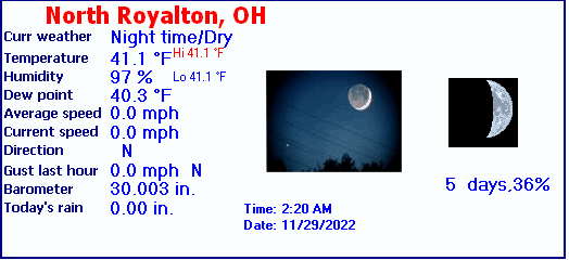
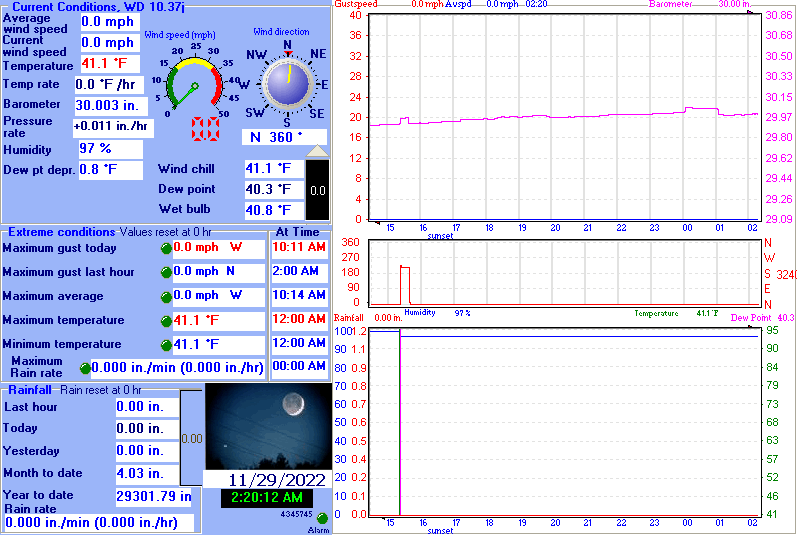
| LAST READING AT TIME: 2:20 AM DATE: November 29 2022 ,Time of next update: 2:30 AM | |||
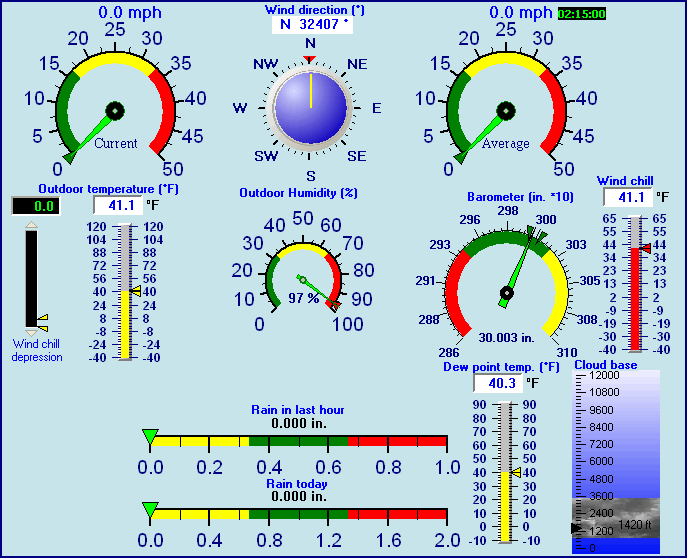
| Current Weather | Night time/Dry | Current Temperature | 41.1°F (5.1°C), Apparent temp 39.7°F |
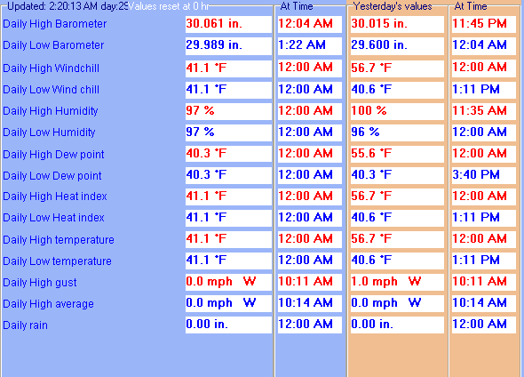
| Maximum Temperature (since midnight) | 41.1°F at: 12:00 AM | Minimum Temperature (since midnight) | 41.1°F at: 12:00 AM |
| Average windspeed (ten minute) | 0.0 mph | Wind Direction (ten minute) | N (360°) |
| Windchill Temperature | 41.1°F | Maximum Gust (last hour) | 0.0 mph at: 2:00 AM |
| Maximum Gust (since midnight) | 0.0 mph at: 10:11 AM | Maximum 1 minute average (since midnight) | 0.0 mph at: 10:14 AM |
| Rainfall (last hour) | 0.00 in. (0.0 mm) | Rainfall (since midnight) | 0.00 in. (0.0 mm) --- |
| Rainfall This month | 4.03 in. (102.4 mm) | Rainfall To date this year | 29301.79 in. (744266.9 mm) |
| Maximum rain per minute (last hour) | 0.00 in/min | Maximum rain per hour (last 6 hours) | 0.00 in/hour |
| Yesterdays rainfall | 0.00 in | DewPoint | 40.3°F (Wet Bulb :40.8°F ) |
| Humidity | 97 %, Humidex 39.6°F | Barometer corrected to msl | 30.003 in. (1016.0 hPa) |
| Pressure change | +0.01 in. (last hour) | Trend (last hour) | STEADY |
| Pressure change (last 12 hours) | +0.10 in | Pressure change (last 6 hours) | +0.03 in |
Use the RELOAD facility on your browser to retrieve the latest data.