K8YSE LAKE SUPERIOR SATELLITE GRID EXPEDITION - AUGUST 2010
UPDATES:
As of 10/29/2010, all but approximately 77 qso's with 35 different stations have been processed and mailed. More cards were needed to finish the rest and should be in shortly. There were about 318 unique callsigns in the log after purging the /p's etc. It took quite a while to do cards for over 2000 contacts but the end is now within sight. If there is a contact that you made that you need for a new grid and did not receive a card for it, just email me with the particulars and I'll check the log and/or recordings.
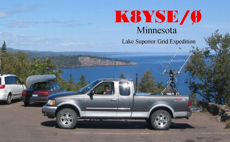
All contacts for the grid expedition have been transferred from the paper log to a computer excel spreadsheet. We logged 2069 qso's in 32 grids on 168 passes during our 5 week trip. QSL cards have been ordered (11 different for the various areas we operated from). Here's a sample of the Minnesota card. The photo was taken at Palisade Head, high above Lake Supeior. Shovel Point is in the background.
Thanks to everyone who made the special effort to work me. Many stations were there every day and that was very encouraging.
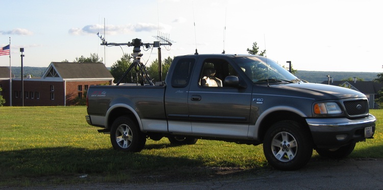
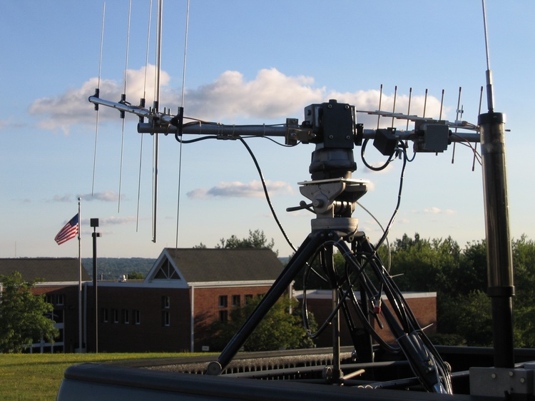
A grid expedition is planned beginning August 2nd that will cover all of the grids around Lake Superior in both Canada and the US. Some of these grids are very rare and might be difficult to operate from. A specific schedule is not possible, however, there will be an APRS beacon (K8YSE-8) that will help. When not in terrestrial digi range, the ISS digi will be used whenever available. It might not be real time, but will be better than no report at all. This is a sightseeing trip with a focus on satellite operations. I will not be on every visitble pass but will be on every day from somewhere. Once underway, KD8CAO, will be the best source of information.
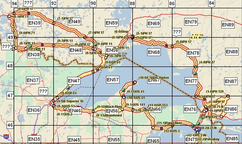
The list of potential grids is as follows:
EN28-29-36-37-38-39- 46-47-48-49-56-57-58-59-63-64-65-66-67-68-69-73-74-75-76-
77-78-79-83-84-86-87 and EO30 in both the US and Canada.
Although this is a satellite expedition, some operation will be on six meters including an all day satellite/6 meter effort from Brockway Mountain, Copper Harbor Michigan, in EN67.
If you have specific requests, please send an email. There are no specific dates/schedules but the APRS info will help you to keep track of the progress.
QSL requests are not necessary. It is planned to QSL every contact in the log. If you do send a request/SASE, please wait until the expedition is over and just send one with all contacts listed.